Grand Canyon Rim Trail - Mather Point to Yavapai Point
Grand Canyon National Park was designated as our country’s 17th national park over a century ago on February 26th, 1919. This week we’re heading out to explore two of the most popular overlooks along the south rim. Join me at Mather Point and Yavapai Point.
FAST FACTS
• Distance: 1.5 miles RT
• Elevation Change: 50 ft
• Difficulty: Easy
South Rim Trail in Grand Canyon National Park
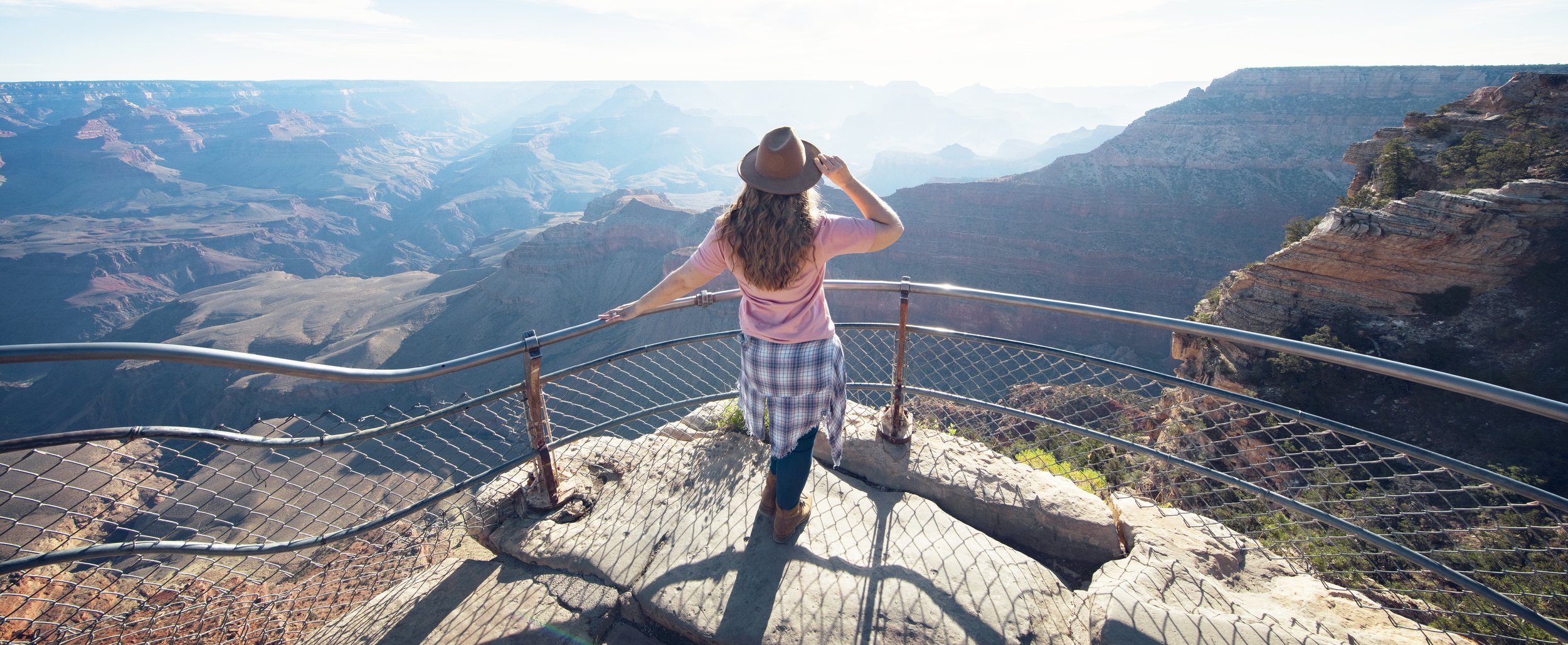
Grand Canyon views along the South Rim Trail
The full Rim Trail along Grand Canyon’s southern rim stretches 13 miles from the South Kaibab Trailhead to Hermits Rest. The path has less than 200 feet in elevation change and is mostly paved, making it a great day hike…especially since you can catch the free shuttle back to your vehicle once you’ve finished. If you don’t have time to hike the full 13 miles, Mather Point, Yavapai Point and the trail section between them are a wonderful, easily accessible sampling of the full South Rim Trail.
Rim Trail in Grand Canyon National Park
Mather Point in Grand Canyon National Park
Mather Point
Named for Stephen Tyng Mather, the first director of the National Park Service, Mather Point is probably the most popular overlook inside Grand Canyon National Park because it’s the first major overlook most south rim visitors will encounter. It’s centrally located less than half a mile from the Grand Canyon Visitor Center, and the gentle paved walk reaches this overlook in less than five minutes from parking lots 1-4.
Grand Canyon view to the east from Mather Point
Vulture soaring below Mather Point
Mather Point is often considered the best spot for sunrise in the park and the panoramic views here are unparalleled. On a clear day you can see over 30 miles to the east and over 60+ miles to the west. Looking down into the canyon, you can get a small glimpse of the Colorado River, Phantom Ranch at the bottom of the canyon, and numerous trails dotting the landscape. Because this spot is so easily accessible and popular with park crowds, you shouldn’t expect to get the views here to yourself. However, in my personal experience, I’ve found that just after sunrise many of the morning photographers head out and families have not arrived, making it the best time to enjoy the vast serene beauty here.
Yavapai Point seen from the Rim Trail
Yavapai Point in Grand Canyon National Park
Yavapai Point
The paved trail continues on just over half a mile from Mather Point to Yavapai Point. While there are multiple lookouts in between the two points, Yavapai Point is the northern most point in this area and I personally think it’s one of the best panoramic views along this section of the Rim Trail. Here you can take in the vast views & see Plateau Point, Bright Angel Canyon, Isis Temple, and even a glimpse of the Colorado River.
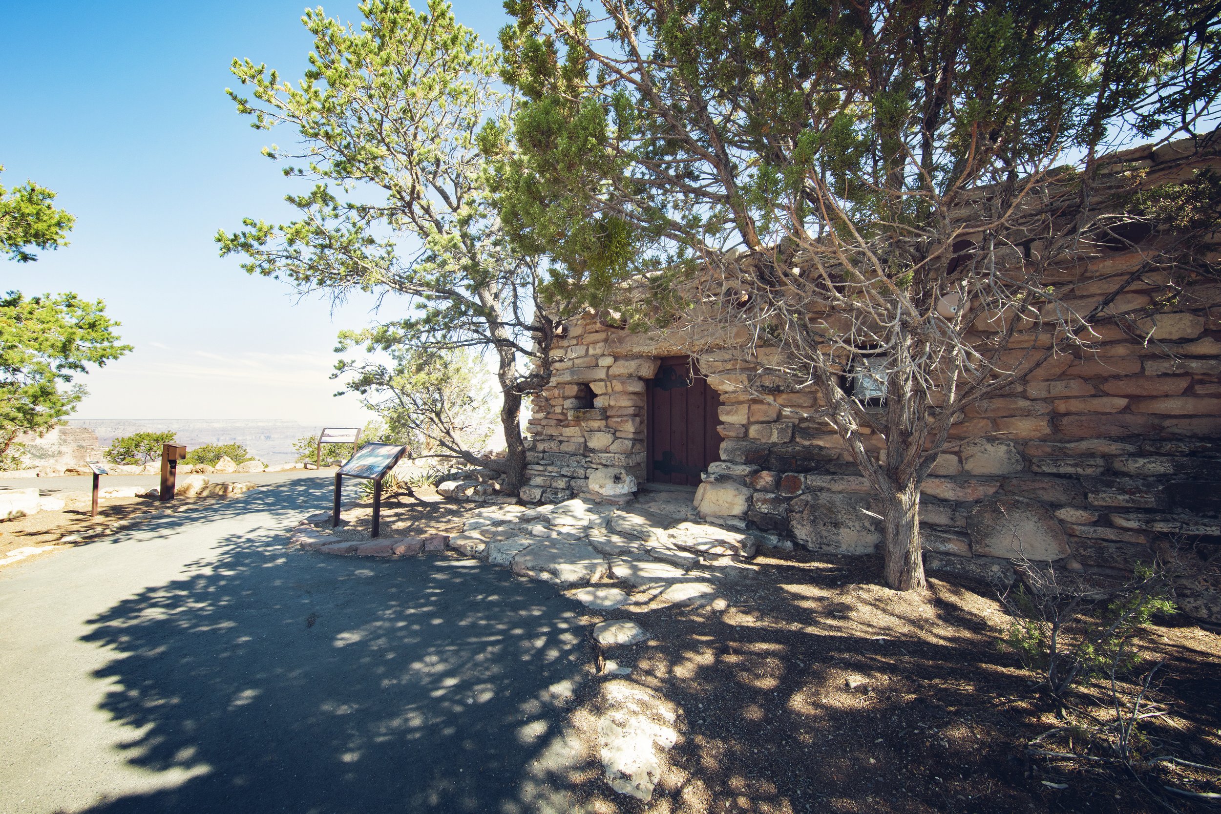
Yavapai Geology Museum along the Rim Trail
Informative panels with views inside the Yavapai Geology Museum
The Yavapai Geology Museum is also located here, perched on the canyon rim. The original structure was designed by architect Herbert C Meyer and built in 1928. Local ponderosa pine and kaibab limestone were used in the construction process so the museum would blend into the natural surroundings. Open to the public daily from 8am-6pm, the museum provides informative displays and interpretive panels, along with incredible canyon views and a small snack/gift shop area. Just to the east of the museum doors is an observation viewpoint of the suspension bridge far below, dangling above the Colorado River.
Yavapai Point in Grand Canyon National Park
Know Before You Go
• Consider visiting the above mentioned spots for sunrise (or early in the morning) for the canyon’s incredible color show and to avoid large crowds.
• At both Mather Point and Yavapai Point you may see coins, food, or paper money tossed and sitting on the outstretched cliffs. Please do not litter or throw coins/money here. It is incredibly unsafe for the local wildlife…in fact, a California condor died here after swallowing coins.
• Please remember and follow all the Leave No Trace Principles on your visit.
• While much of the north rim closes for Winter due to snow, the south rim of the park remains open year-round, so these spots can be viewed in all four seasons.
• Both Yavapai Point and Mather Point have protective guard rails to keep you safe, but multiple views along the trail are completely unobstructed and wide open with sheer drop offs. Please explore at your own skill and comfort level, and remember the Grand Canyon is over one mile deep.
• Wildlife is abundant in the park – from rattle snakes and tarantulas to deer and elk. Please remember to give wild animals plenty of space as we are guests in their home, and never leave food unattended. Unfortunately people often approach or try to feed the friendly looking squirrels here…please do not do this! Not only is it unhealthy for them to stop foraging for their natural food sources, they can scratch or bite unexpectedly and they carry many diseases (including the plague), so stay safe and keep your distance.
• Hiking in this park is a wonderful experience but the Grand Canyon is prone to inclement weather. Take time and understand the weather patterns here. Dehydration is the biggest safety issue for hikers in the park. Make sure you have plenty of water, sunblock, a wide-brimmed hat, and consider hiking early in the day to avoid heat related illness in the hot Summer months.
Top 10 Grand Canyon Highlights
Mather Point & Rim Trail
Desert View Road
Shoshone Point Trail
Desert View Watchtower
Bright Angel Trail
Hermit Road & Hermits Rest
Ooh Aah Point
Lipan Point
Mojave Point
Powell Memorial Point
In Summary
Thanks so much for joining me this week in Grand Canyon National Park. For a virtual visit of Mather Point and Yavapai Point, see my Behind the Blog at the top of this post, or watch it on YouTube here. Until next week, I hope you find adventure and encouragement wherever you go.
Rim Trail views of the Grand Canyon
If you enjoyed this post, you might also like…
About Me
I’m Dawn Marie, a travel and lifestyle blogger based out of Southern California. With in-depth articles, travel guides, and reviews on hotels & products, I seek to share my journeys to help you plan for your own. My adventures take me all over California, the western United States, and around the globe...and every Monday I post new content here, including a comprehensive blog post and YouTube video.
Search the Blog
Featured Posts
Etsy Shop


When is the best time to visit Yosemite National Park? This seasonal travel guide breaks down spring, summer, fall & winter in Yosemite—what the park looks like, pros & cons of each season, top places to visit, and expert tips to help you plan the perfect road trip. Find out the best time to see raging waterfalls, fall colors, spring wildflowers, abundant wildlife, or snow-capped granite peaks.