Ultimate 1-Day Itinerary for Death Valley National Park: A Complete Day Trip Guide
Hi friends! This week we’re exploring the incredible desert terrain of Death Valley National Park! Covering parts of California and Nevada, this is one of the West Coast’s most diverse and underrated national parks. From towering sand dunes and colorful canyons to vast salt flats and epic scenic drives, this park is packed with adventure. Whether you’re taking a road trip up US-395 or you’re looking for a day trip excursion from Las Vegas, visitors are often limited to only one day in Death Valley National Park...and if that’s the case for you, don’t worry—I’ve got you covered!
Continue reading below for a perfect 1-day itinerary that will take you to must-see spots, stunning viewpoints, and top hiking trails, while offering insider tips and practical information for a smooth visit.

Badwater Basin in Death Valley National Park
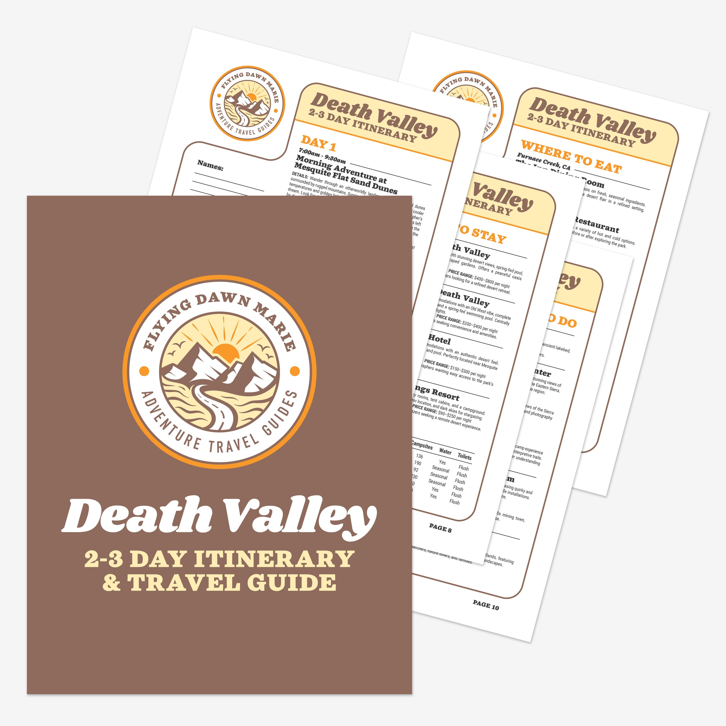
Death Valley 2-3 Day Itinerary & Travel Guide
If you’re planning a multi-day road trip to Death Valley, make sure to download my complete Death Valley 2-3 Day Itinerary & Travel Guide, which includes an hour-by-hour schedule, Google & Apple map pin locations, the best stargazing spots, a complete dining guide, recommendations on where to stay, desert safety guide, and more!

Zabriskie Point badlands in Death Valley
Park & Itinerary Overview
Death Valley National Park spans southeastern California and western Nevada, covering over 3.4 million acres and making it the largest national park in the contiguous United States. Death Valley is home to the lowest point in North America, with Badwater Basin sitting 282 feet below sea level. Death Valley also holds the distinction of being the hottest place on earth with a recorded temperature of 134°F in 1913!
Today’s one-day guide will take you to:
• Mesquite Flat Sand Dunes
• Harmony Borax Works
• Zabriskie Point
• Furnace Creek
• Artist’s Drive & Artist’s Palette
• Natural Bridge Trail
• Badwater Basin


Mesquite Flat Sand Dunes in Death Valley
Stop 1: Mesquite Flat Sand Dunes
Time: 7:00-9:00am
Location: Near Stovepipe Wells off CA-190
Distance: No designated trails, explore freely
Difficulty: Easy to Moderate (walking on soft sand can be tiring)
Highlights: Towering dunes, rippling sand patterns, epic sunrise photography
The Mesquite Flat Sand Dunes are some of the most photogenic dunes in California. With rolling golden hills stretching across the horizon, they are especially magical at sunrise. The cool morning light creates soft shadows and golden hues, making this one of the best photography spots in the park.
If you’re up for a challenge, hike to the highest dune (over 100 feet tall) for a breathtaking panoramic view. Unlike many other dunes in Death Valley, Mesquite Flat is easily accessible off the main road, making it a great stop for all visitors.
👉Tip: The sand gets incredibly hot by midday, so visit early in the morning. Closed-toe shoes are a must.
For more info on this top spot in Death Valley, check out my full Mesquite Flat Sand Dunes blog post.
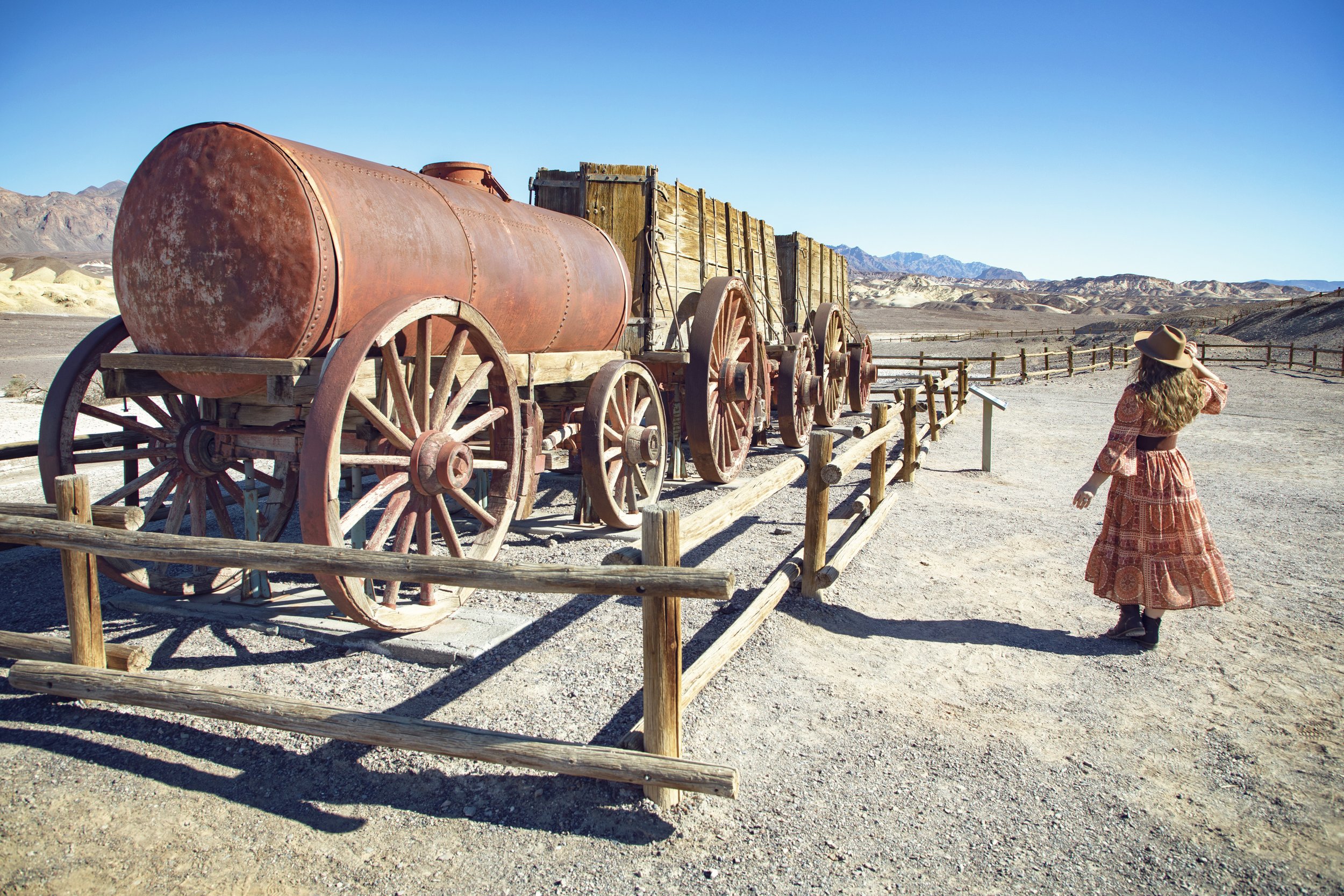
20 mule team wagon at Harmony Borax Works
Stop 2: Harmony Borax Works
Time: 9:00-10:30am
Location: Near Furnace Creek off CA-190
Distance: 0.4-mile loop
Difficulty: Easy
Highlights: Historic borax mining site, 20 Mule Team wagons, interpretive signs
This short trail takes you through the remains of one of Death Valley’s most famous mining operations. In the late 1800s, borax was extracted here and transported across the desert using massive 20-mule team wagons. Today, you can walk through the site, see old rusted equipment, and learn about the industry that shaped early Death Valley history.
👉Tip: This stop is great for history buffs, and drive down to the old worker ruins before leaving this area.
For more info on this top spot in Death Valley, check out my full Harmony Borax Works blog post.

Exploring Zabriskie Point in Death Valley National Park
Stop 3: Zabriskie Point
Time: 10:30-11:30am
Location: Near Furnace Creek off CA-190
Distance: 0.25-mile paved walk
Difficulty: Easy (accessible viewpoint)
Highlights: Dramatic badlands, sweeping valley views, golden rock formations
One of the most iconic viewpoints in Death Valley, Zabriskie Point overlooks a surreal maze of golden badlands. The eroded hills were once part of an ancient lakebed, and today they form one of the most unique landscapes in the park. This short, paved walk leads to a panoramic viewpoint that’s truly stunning.
👉Tip: Extend your adventure here by continuing on to Badlands Loop, which takes you down into this otherworldly terrain.
For more info on this top spot in Death Valley, check out my full Zabriskie Point blog post.

Fuel Prices in Furnace Creek, CA
Stop 4: Lunch in Furnace Creek
Time: 11:30-12:30pm
Location: Off CA-190
Dining options are limited inside the park, so stop at The Oasis at Death Valley. Lunch is served from 11-2 daily at the Inn Dining Room at The Inn at Death Valley, or visit The Ranch at Death Valley to enjoy lunch at The Wild Rose Tavern, The 1849 Restaurant, or the Ice Cream Parlor. Consider topping off your gas tank while you’re here...just be ready for some steep prices!
👉Tip: Stop by the Furnace Creek Visitor Center to view park exhibits and the bookstore with a wide range of educational items for all ages before continuing on your adventure.

Artist’s Palette along Artist’s Drive in Death Valley
Stop 5: Artist’s Drive & Artist’s Palette
Time: 12:30-2:30pm
Location: Scenic loop off Badwater Road
Distance: 9-mile scenic drive (several stops along the way)
Difficulty: Easy (drive with optional short walks)
Highlights: Vibrant mineral-colored hills, winding roads, scenic overlooks
This one-way scenic drive winds through a landscape filled with stunning colorful hills—reds, pinks, purples, and greens created by mineral oxidation. The highlight is Artist’s Palette, where the colors are most vibrant.
👉Tip: If you only stop and explore one place along this loop drive, make sure it’s Artist’s Palette.
For more info on this top spot in Death Valley, check out my full Artist’s Drive blog post.

Hiking Natural Bridge Trail in Death Valley National Park
Stop 6: Natural Bridge Trail
Time: 2:30-4:30pm
Location: Off Badwater Road via a 1-mile dirt road (passable for most vehicles)
Distance: 2 miles round-trip
Difficulty: Easy to moderate (gradual incline, rough & rocky terrain)
Highlights: A massive rock arch towering over the canyon floor, dry waterfall, unique erosion patterns
Tucked away in a narrow canyon just off Badwater Road, the Natural Bridge Trail is a short yet rewarding hike that leads to one of Death Valley’s most striking geological formations. The trail follows a dry wash through a towering canyon, where flash floods have carved smooth rock walls and dramatic erosion features. The main attraction is Natural Bridge, a massive rock arch that stretches across the canyon, creating a dramatic tunnel-like passage. Beyond the bridge, you’ll find dry waterfalls and sheer rock faces, making this hike feel like a hidden desert adventure.
👉Tip: The canyon provides a little shade in the late afternoon, making it a great hike to escape the midday heat. Don’t stop at the bridge like most visitors...continue on to see the dry waterfalls.
For more info on this top spot in Death Valley, check out my full Natural Bridge Trail blog post.
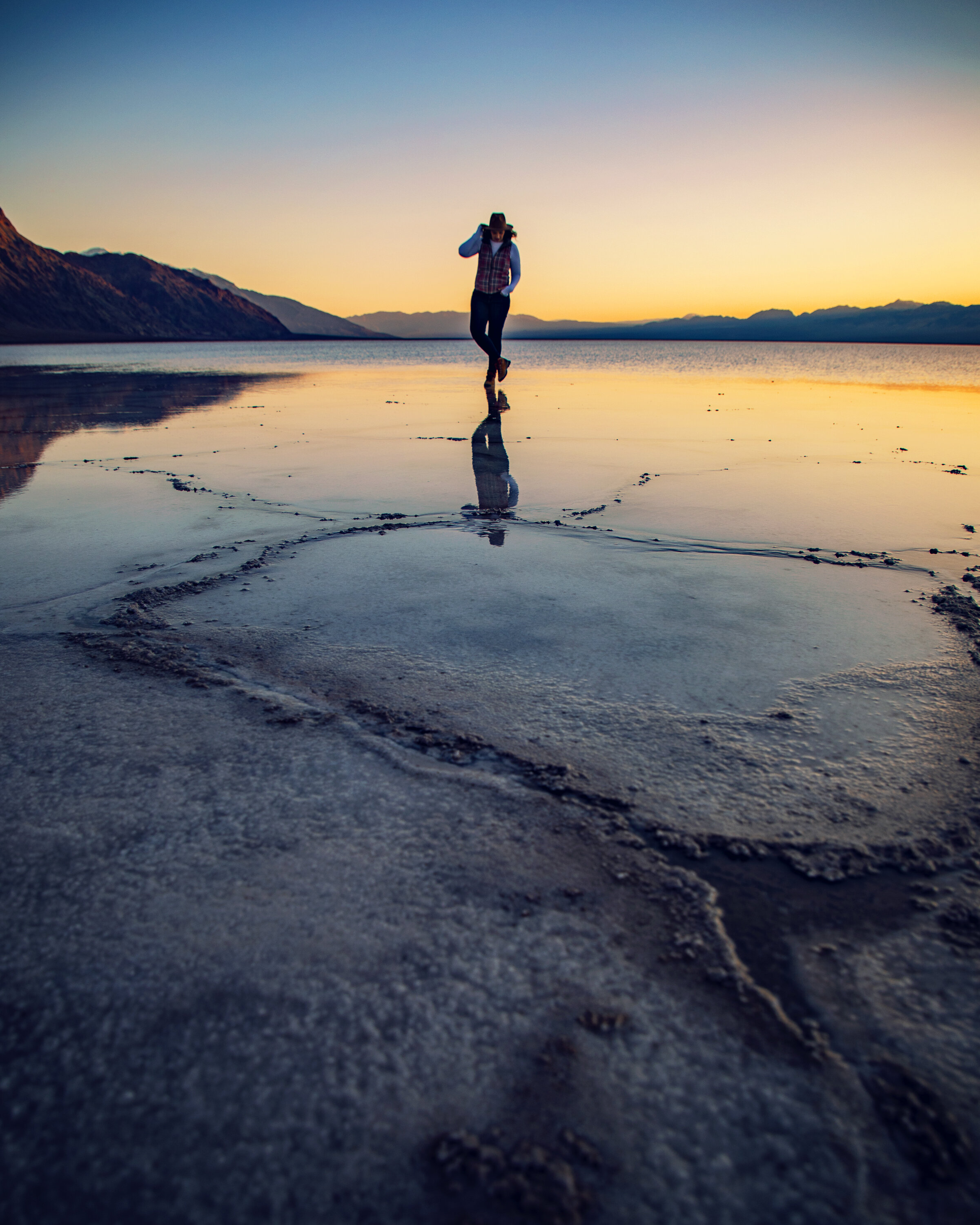
Reflections on Badwater Basin at sunset after a storm
Stop 7: Badwater Basin
Time: 4:30-6:30pm
Location: Off Badwater Road
Distance: 1-mile round-trip to best salt formations
Difficulty: Easy (flat terrain)
Highlights: Lowest point in North America, vast salt flats, incredible reflections
Finish off the day at Badwater Basin, the lowest point in North America at 282 feet below sea level. The salt flats here stretch endlessly, creating a surreal, almost alien-like landscape with white hexagonal salt formations that look like snow. If there's been rain, you may even see beautiful mirror-like reflections on the salt surface.
👉Tip: Sunset is the best time for photography, as the low sun creates a dramatic, golden glow over the salt flats. Stick around after dark because the night sky and Milky Way views found here are out of this world!
For more info on this top spot in Death Valley, check out my full Badwater Basin blog post.

Stargazing at Badwater Basin in Death Valley
Know Before You Go
• Visit the official Death Valley NPS website for the most accurate and up-to-date information before your trip.
• The best time to visit Death Valley is from November to March, when temperatures are mild (60-75°F). Spring can sometimes bring wildflower blooms, while hiking in the summer months should be limited or avoided due to extreme heat, exceeding 120°F.
• Entrance fees are $30 per vehicle (valid for 7 days), or you can purchase the $80 America the Beautiful Pass (annual pass for all U.S. national parks). Pay at fee kiosks or Visitor Centers at Stovepipe Wells or Furnace Creek...or ahead of time online.
• There are limited gas stations inside the park at Furnace Creek, Stovepipe Wells, and Panamint Springs, but prices are high. Fuel up before entering the park. Drive responsibly, as motor vehicle accidents are the most common causes of death in the park.
• There is no reliable cell service in most of Death Valley. Free WiFi is available at the Furnace Creek Visitor Center if you get in a pinch.
• Bring a reliable GPS-enabled device with pre-downloaded maps for offline use. I love using Gaia GPS...it’s been a life-saver. Since they’re a partner of mine, my readers can get 10% off. Visit GaiaGPS.com to sign up.
• Please remember the Leave No Trace Principles so this park’s natural beauty can be enjoyed for years to come. Collecting, removing, or disturbing natural features or historic artifacts is strictly prohibited.
• Pets are not allowed on any trail in Death Valley National Park.
• What to Pack: At least one gallon of water per person per day, high-SPF sunscreen, sunglasses, a wide-brimmed hat, snacks, and layered clothing (mornings and evenings can be chilly).
• For recommendations on dining and where to stay in and around Death Valley National Park, check out my comprehensive Death Valley 2-3 Day Itinerary & Travel Guide, which includes details on local restaurants and hotels.
Top 10 Things to Do in Death Valley

Death Valley views from Artist’s Palette
In Summary
Thanks so much for joining this me this week inside Death Valley National Park. For a virtual visit of this 1-day itinerary, make sure to watch my Behind the Blog video located at the top of this post, or watch it on YouTube here. Until next week, I hope you find adventure and encouragement wherever you go.

Ruins at Harmony Borax Works in Death Valley
If you enjoyed this post, you might also like…


About Me
I’m Dawn Marie, a travel and lifestyle blogger based out of Southern California. With in-depth articles, travel guides, and reviews on hotels & products, I seek to share my journeys to help you plan for your own. My adventures take me all over California, the western United States, and around the globe...and every Monday I post new content here, including a comprehensive blog post and YouTube video.
Search the Blog
Featured Posts


Etsy Shop

Embark on a California desert road trip to explore otherworldly landscapes, unique rock formations, and stunning desert scenery. Visit Red Rock Canyon, Trona Pinnacles, Death Valley National Park, Alabama Hills & Fossil Falls. Discover epic stargazing, hidden hikes, scenic drives, and surreal photo spots on this unforgettable desert adventure with this complete travel guide & itinerary.