First-Timer's Guide to Tioga Pass - Yosemite National Park
Hi friends! The opening up of Tioga Pass in Yosemite National Park each year is an exciting time, and it’s one of the most underrated sections of the park. Today I’m thrilled to partner with Visit Yosemite | Madera County to put together a complete list of my favorite stops along Tioga Road for first-time visitors, as well as information on the best times to travel here. Join me below as we explore Yosemite’s “high country” along this incredible stretch of Highway-120.
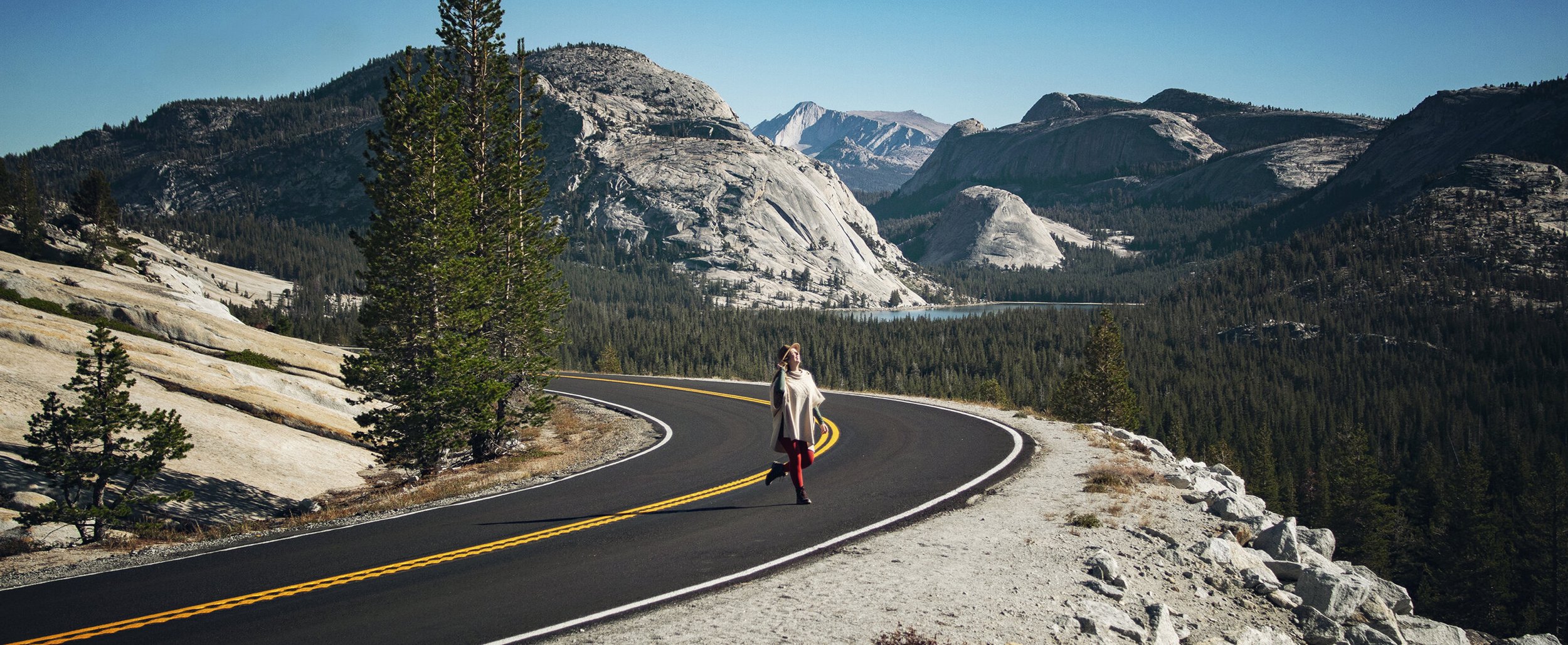
Yosemite high country seen from Tioga Road near Olmsted Point
Location
Tioga Pass is the highest elevation highway through the Sierra Nevada Mountains and in all of California. Tioga Road is a section of Highway-120 that cuts across the northern “high country” of Yosemite National Park. It connects US-395 near Mono Lake with Big Oak Flat Road on the west side of the park. The highest point along the drive is 9,945 ft above sea level, which is located at the Tioga Pass Entrance to Yosemite National Park.
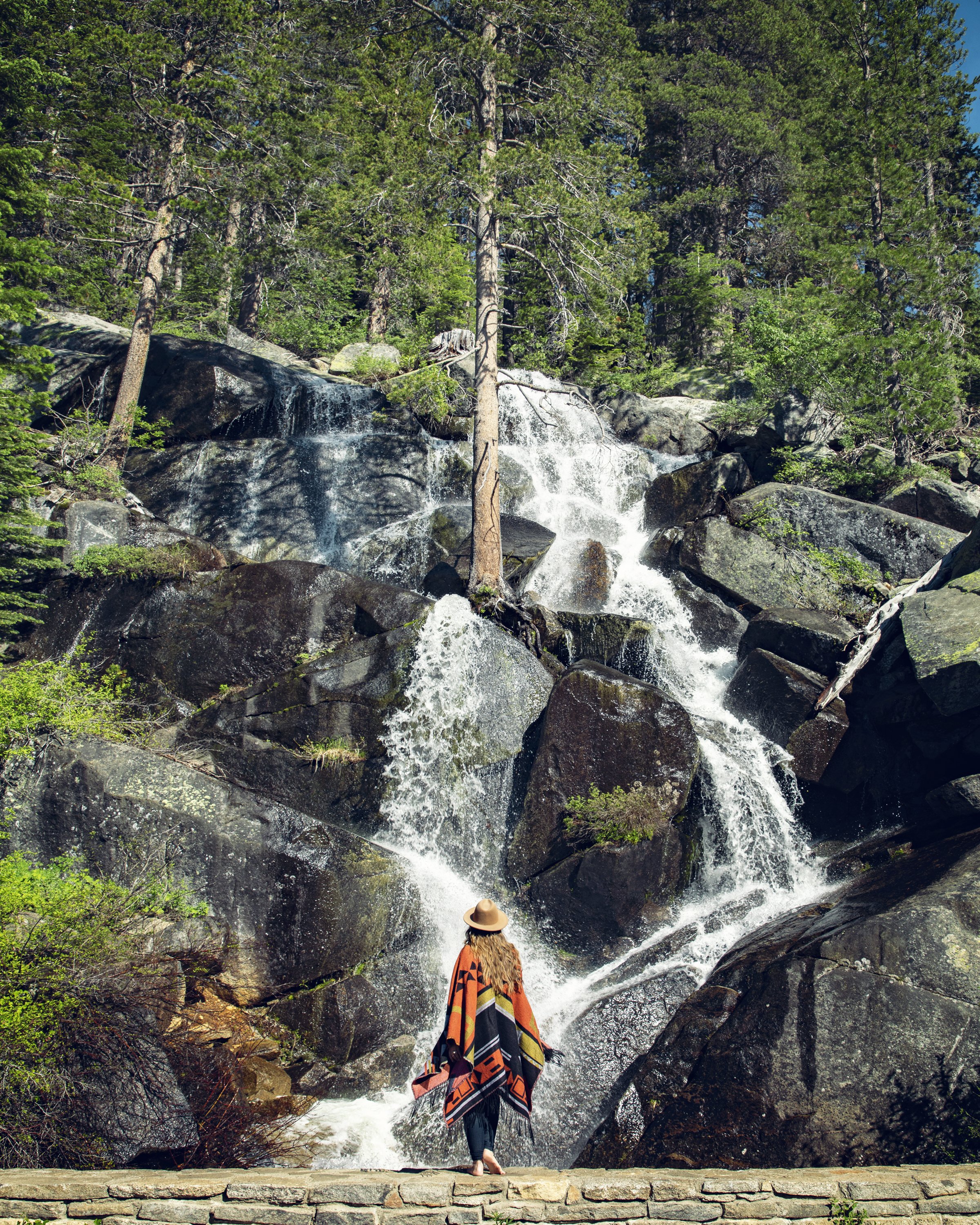
Seasonal waterfall along South Fork Tuolumne River (July 2023)
Quaking Aspen Falls (aka Tioga Pass Falls) seasonal waterfall (July 2023)
Best Times to Visit
Due to the high elevation of Tioga Pass, there’s a relatively short window to enjoy all that this area of Yosemite’s high country has to offer. Much of the year Tioga Road is closed as it is completely buried in snow during the Winter and Spring months. Typcially, plowing of this road begins around mid-April and can take up to 2 months to complete, depending on the amount of accumulated snow. The difference in the 2022 and 2023 seasons are a perfect example of the wide range in opening dates...in 2022 Tioga Road opened on 5/27, and in 2023 the extraordinary Winter weather pushed back the opening to 7/22. Similarly, the closing date is also dependent on weather. Typically Winter weather starts to hit Yosemite’s high country sometime in late October to mid-November, bringing the Tioga Pass season to a close.
My two favorite times to visit are right when it opens in late Spring/early Summer, and then again in October. There are a couple spots that have beautiful seasonal waterfalls right off the highway (Quaking Aspen Falls and South Fork Tuolumne Falls). Visiting right after the road opens for the season increases the chances I’ll get to see them before they dry up by mid-to-late Summer. Early October is also a beautiful time to take a Tioga Pass road trip. As you travel east towards and beyond the Yosemite Tioga Pass Park Entrance, you’ll be treated with vibrant Fall colors. Unlike the Yosemite Valley, this region offers views of the shimmering aspen leaves that have become synonymous with Autumn in the Eastern Sierra.
Tioga Pass Fall colors along Lee Vining Creek (October 2022)
Tioga Road in Yosemite National Park (July 2023)
History
Long before there was a Tioga Road, indigenous peoples created paths across this unforgiving terrain of the High Sierra. Evidence dating back as far as 2,000 BC shows that native tribes, such as the Miwok along the western slopes and the Eastern Mono, developed routes in order to trade goods like arrowheads, acorns, berries, pine nuts, obsidian, and salt.
Tioga Road was first built in 1883 and was called the Great Sierra Wagon Road. It was constructed in 130 days by the Great Sierra Consolidated Silver Company to service their mining operations, and it covered over 56 miles, rising from 4,200 feet elevation to nearly 10,000 feet. Tioga Pass officially opened to cars as an all-dirt road in 1919...but as visitation to Yosemite increased, so did the traffic on the Tioga Road, which was finally paved in 1937.
Tioga Road in Yosemite National Park
Half Dome seen from Olmsted Point
Tioga Road Highlights
Olmsted Point
Olmsted Point is famous for its pristine views of Half Dome and Clouds Rest right from the parking lot (which is rarely empty, but has plenty of space for vehicles, RVs and buses). While you can make this a quick stop for a perfect photo op from your car, there are also informational panels about the area and history here, along with a bronze map of the landscape. If you have a little more time, you can take the official trail for a short five minute walk down for even more unobstructed views. The path is dotted with boulders that moved with glaciers centuries ago, and it’s great to scramble around the wide open granite here.
For more information on this spot, as well as details for secret add-on hike without the crowds here, check out my full Olmsted Point blog post.
Tenaya Lake in Yosemite National Park (July 2023)
Tenaya Lake along Tioga Pass in Yosemite National Park
Tenaya Lake
Located right off Tioga Road, Tenaya Lake sits at an elevation of 8,150 ft and is the largest natural lake in Yosemite, measuring over a mile long. This lake was named after Chief Tenaya, a prominent Ahwahnechee leader here. Before the Mariposa Battalion drove out Yosemite’s original residents, the Ahwahnechee had long given this lake a very different name, “Pie-we-ack”, meaning lake of shining rocks. Formed by Tenaya Glacier, which flowed from the Tuolumne Ice Sheet to the Yosemite Valley, this lake is surrounded by stunning granite.
For more information on this spot, check out my full Tenaya Lake blog post.
Tuolumne Meadows & Tuolumne River along Tioga Pass (September 2019)
Tuolumne Meadows, Tuolumne River & Lembert Dome (July 2023)
Tuolumne Meadows
Situated at 8600 ft above sea level, Tuolumne Meadows is a large open space framed by lush evergreens and granite domes with the Tuolumne River snaking its way across it. There are numerous hiking opportunities in this area, and it’s a great spot for wildlife viewing. There are multiple pullouts and parking areas all along the meadow with trail systems that are interconnected, making its features easy to access – even on busy days in the park. Click here for a downloadable NPS map of the Tuolumne Meadows area, which includes hiking trails, camping spots, and more.
Lembert Dome in Yosemite National Park
Lembert Dome
Perched above the Tuolumne Meadows, Lembert Dome is a large granite dome with spectacular panoramic views from the top. The hike is relatively short at under 3 miles round trip, but it’s a steep climb with 900 feet in elevation gain.
Pothole Dome along Tioga Pass in Yosemite
Pothole Dome
If the steep hike to the top of Lembert Dome feels a bit daunting, Pothole Dome is a great alternative. Located on the opposite side of the Tuolumne Meadows from Lembert Dome, Pothole Dome requires roughly a mile and a half round trip with only a couple hundred feet in elevation gain. The views from the top are certainly breathtaking, especially if you head up for sunrise.
For more information on this spot, check out my full Pothole Dome blog post.
Soda Springs in Tuolomne Meadows along Tioga Pass
Parsons Memorial Lodge in Yosemite National Park
Soda Springs & Parsons Memorial Lodge
The hike to Soda Springs and Parsons Memorial Lodge takes you about a 3/4 mile through the Tuolumne Meadows along the Tuolomne River. This is a wonderful and gentle family friendly trail, providing incredible views of the meadow, Lembert Dome, and Unicorn Peak in the distance. Once you reach Soda Springs, you’ll be met with a bubbling spring with an old log structure that was once used to protect cattle from drinking the carbonated water here. Also nearby is the Parsons Memorial Lodge, a historic structure built by the Sierra Club in 1915.
For more information on this spot, check out my full Soda Springs & Parsons Memorial Lodge blog post.
Siesta Lake along Tioga Road in Yosemite (September 2019)
Siesta Lake
Located along the more wooded western section of Tioga Road (about 13 miles east of Crane Flat Gas Station), Siesta Lake makes for a quick, but lovely stop. This small alpine lake is the perfect backdrop for a picnic, and it can be great for a refreshing dip on a hot summer day.
Half Dome seen from Yosemite high country
Other Notable Hikes
There are so many incredible hiking trails along Tioga Road that offer spectacular views. Hiking in Yosemite’s “high country” is perfect for the day-hiker who wants to escape the crowds of the Yosemite Valley and enjoy the serene beauty of the Yosemite Wilderness and breathe in the fresh alpine air. Below are just a handful of trails that are sure to impress...
Tuolumne Grove: 2.5 miles RT, 400 ft elevation change
May Lake: 2.5 miles RT, 500 ft elevation change
Elizabeth Lake: 5 miles RT, 1000 ft elevation change
Cathedral Lakes: 7 miles RT, 1000 ft elevation change
North Dome & Indian Rock: 9.5 miles RT, 900 ft elevation change
Clouds Rest: 12.5 miles RT, 2700 ft elevation change
Tioga Lake morning reflections along Tioga Road
Outside of the Park
Tioga Lake & Ellery Lake
Just outside of the Tioga Pass Yosemite entrance are a pair of beautiful alpine lakes about a mile apart along Tioga Road. Each one offers multiple campsites, as well as pullouts along the highway for road-trippers on their way into the park to stop off and soak in the views...and these views are certainly worth the stop! Quite often in the mornings the waters are still, perfectly reflecting Mount Dana and the rugged mountain-scape.
Tioga Pass Valley Overlooks
Just east of Ellery Lake, Highway-120 traverses above a steep canyon framed by towering Sierra Nevada peaks. These epic views can be enjoyed from multiple pullouts along the scenic drive. One of my favorite spots is the viewpoint at the far west-side of the valley where you can see the waterfall from Lee Vining Creek spill down into the vast chasm below.
Unicorn Peak and Cockscomb Peak in Yosemite National Park
Know Before You Go
• The Travel Alerts page on YosemiteThisYear.com is a great resource to reference prior to any Yosemite trip. There you’ll find up-to-date park information, road conditions, and links to everything you might need while preparing for your trip.
• Check the official NPS website prior to heading out towards the high country for the most up-to-date weather and road conditions.
• Wilderness, by definition, is an unpredictable and even hazardous place, so stay on the designated trails. Traveling off trail is a leading cause of hiking accidents in Yosemite.
• Remember the Leave No Trace Principles and pack out what you pack in.
• This is black bear country. Bears and other wildlife can be present on trails at any time of the day or night. Feeding and approaching wildlife is dangerous and illegal. Make sure to properly store your food. Bear canisters are required for wilderness food storage for overnight hikers.
• Be prepared for sudden and sometimes hazardous changes in weather and trail conditions.
• Be cautious when crossing swollen streams and turn back if conditions warrant. Good planning and judgment may protect you from unsafe situations and prevent the need for rescue.
Top 10 Things to Do Along Tioga Pass
Tuolumne Meadows
Lembert Dome
Siesta Lake
Tioga Lake & Ellery Lake
Tioga Pass Valley Overlooks
Tuolumne Grove of Giant Sequoias
Tenaya Lake in Yosemite National Park
In Summary & Post Sponsor
Thank you so much for joining me this week in Yosemite National Park’s high country. For a virtual visit along Tioga Pass, make sure to watch my Behind the Blog video found at the top of this post, or watch it on YouTube here.
I’d like to give a special thank you to the sponsor of this post, Visit Yosemite | Madera County. Please consider stopping off to support the small businesses and local economies of the gateway communities surrounding the park. For great information on what to do inside Yosemite National Park and in Madera County directly to the south (along Highway 41), check out YosemiteThisYear.com and @yosemitemadera on Instagram. Until next time, I hope you find adventure and encouragement wherever you go.
Flying on my portable aerial rig at Tioga Lake in October 2017
If you enjoyed this post, you might also like…
About Me
I’m Dawn Marie, a travel and lifestyle blogger based out of Southern California. With in-depth articles, travel guides, and reviews on hotels & products, I seek to share my journeys to help you plan for your own. My adventures take me all over California, the western United States, and around the globe...and every Monday I post new content here, including a comprehensive blog post and YouTube video.
Search the Blog
Featured Posts
Etsy Shop


When is the best time to visit Yosemite National Park? This seasonal travel guide breaks down spring, summer, fall & winter in Yosemite—what the park looks like, pros & cons of each season, top places to visit, and expert tips to help you plan the perfect road trip. Find out the best time to see raging waterfalls, fall colors, spring wildflowers, abundant wildlife, or snow-capped granite peaks.